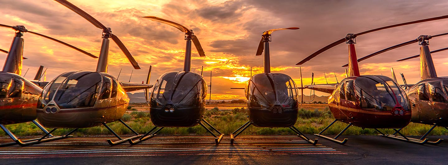
Aerial Surveys, Photography, and Videography for Clarksville, TN
Your Aerial Perspective Over Tennessee
Clarksville Helicopter Charters provides comprehensive aerial survey solutions across Tennessee. Leveraging helicopters' unique low-flying and hover capabilities, we conduct precise magnetometer, electromagnetic, LiDAR, and GIS mapping surveys. Beyond data acquisition, we specialize in advanced aerial filming. Our services include provisioning cutting-edge cinematography and photography technology, from gyro-stabilized mounts to door-off operations for handheld precision. For unparalleled aerial perspectives and data collection over Tennessee, we offer an extensive array of options to meet specific project demands.
Aerial
Surveys
LiDAR, GIS Maps, FLIR, HD Video & More
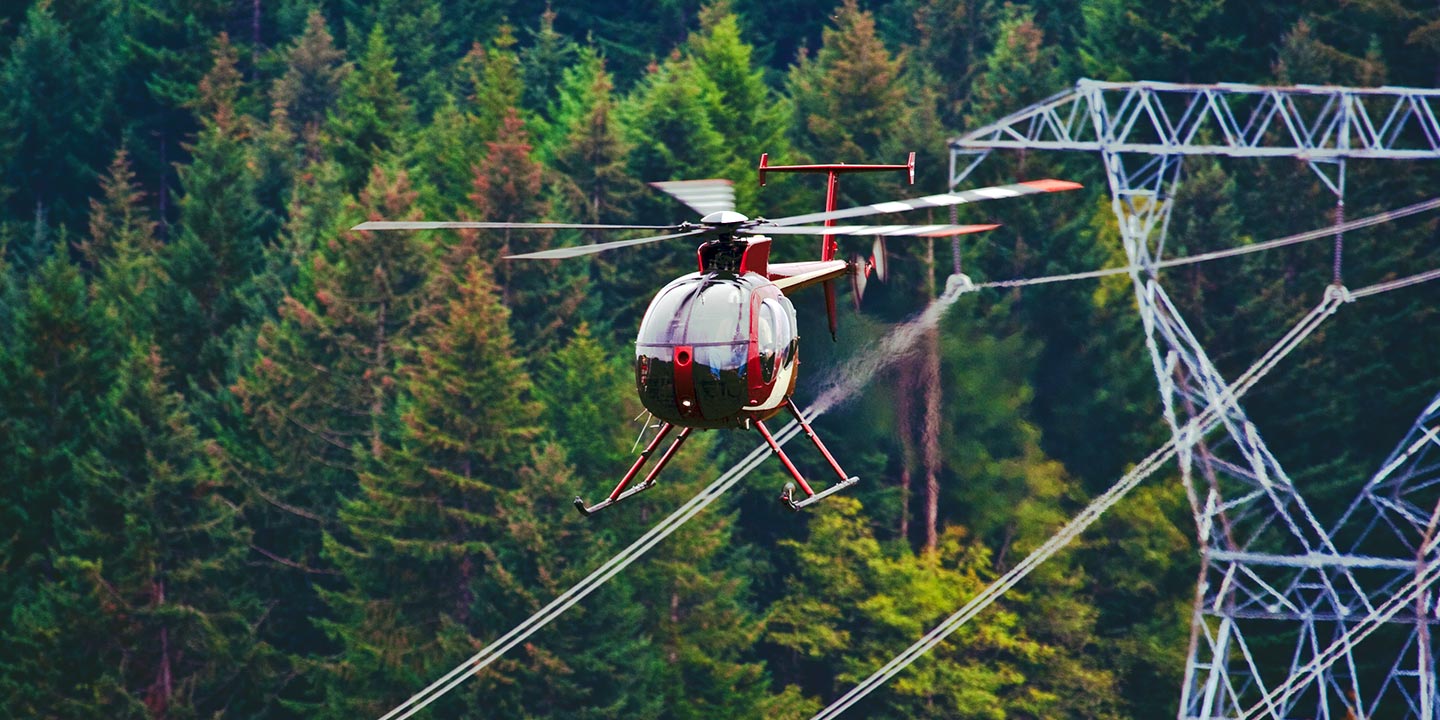
Clarksville Helicopter Charters offers critical aerial support for infrastructure. We specialize in precise pipeline surveys, Right-of-Way (ROW) inspections, and transmission line patrols. We provision the right aircraft and specialized equipment, ensuring accurate and efficient project completion.
High Tech Results
The Top Pilots in Tennessee, Today's Technology... Maximum Results.
Call 1-866-826-4826 Now!
Clarksville Helicopter Charters provides the tools needed to complete your land surveys, utilizing the right equipment to provide the aerial photos that are often needed.
Clarksville Helicopter Charters streamlines commercial projects through effective aerial surveys. Helicopter operations simplify Right-of-Way (ROW) and site inspections, topographical data acquisition, and high-definition imaging. This method offers unparalleled precision for inspecting pipelines, detecting transmission line issues, and documenting properties. We develop bespoke photographic and remote sensing operations, custom-fit to maximize technical efficacy and financial efficiency for your project goals.
Helicopters are ideal for aerial surveying, flying much lower and slower than fixed-wing aircraft. While fixed-wing operations observe FAA minimum altitude requirements of 1,000 feet above obstacles, helicopters operate significantly closer. This capability allows for precise inspection of troublesome or dangerous zones, providing engineers with an otherwise unattainable point of view.
There is no better way to conduct your visual survey, animal population counts, soil drainage analysis, ROW inspections, pipeline and transmission line inspections, and geographical surveys.
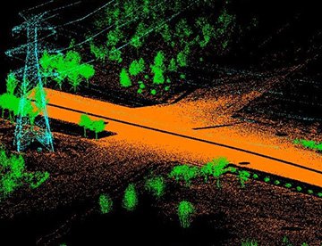
LiDAR Imaging
Light Detection and Ranging, or LiDAR, is a remote sensing method used to examine and measure Tennessee topography as well as objects, like vegetation, upon it.
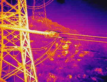
Infrared Imaging
Thermographic IR cameras are used to detect radiation in the long-infrared range of the electromagnetic spectrum and produce images of that radiation, called thermograms.
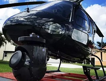
HD Video Gimbal Capture
Modern HD and 4K cameras can be mounted to helicopters, using the proper STCs, with a gimbal to stabilize photos & videos for detailed results.
Advanced Aerial Filming and Professional Videography Services
For expert camera work in the Clarksville Sky
Get a Fast, free QuoteClarksville Aerial Cinematography
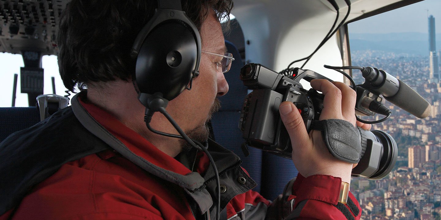
Clarksville Helicopter Charters delivers unparalleled professional-grade aerial cinematography solutions across Tennessee. We facilitate custom shoots using the latest technology, including gyro-stabilized camera mounts like Tyler Mounts, Wesscam, Cineflex, Pictorvision, and SpaceCam. Specialty cameras such as Cineflex HD, RED Epic, Arri Alexa, plus 3D and experimental systems, are provisioned. We support all production goals, from air-to-air to ground-to-air shots, ensuring exceptional cinematography through close collaboration with aerial DPs and directors for precise visual results. Specializing in helicopter support for still and motion photography, Clarksville Helicopter Charters caters to diverse media operations throughout Tennessee: film, television, documentaries, promotional videos, commercials, aerial props, network relief work, and coverage of major sporting or historical events with various helicopter platforms.
Call Us Today at 1-866-826-4826 for a Free Quote
Contact Us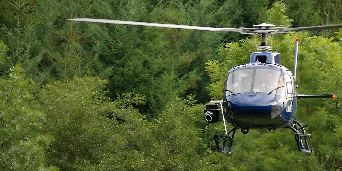
Aerial Photos
Hand-held or Mounted OpTions in Clarksville
We will help you get the right equipment for your aerial photography project! Call 1-866-826-4826 today to get a fast, free quote.
The Most Options for Photography
Clarksville Helicopter Charters offers unique aerial photography opportunities, capturing Tennessee's spectacular landscapes from an unparalleled perspective. These specialized charters are designed to realize your precise creative vision. We provide cost-effective photographic solutions throughout the state, ensuring exceptional results. For dynamic handheld projects, many helicopters can operate with doors removed. For enhanced stability and precision, information on advanced gyro-stabilized camera mounts is available upon request, catering to the most demanding photographic endeavors.
Superior Service
Every one of our customers gets a dedicated helicopter expert to assist with flight plans, tech loadouts, production logistics, project schedules, and other demands.
Over 500 Aircraft
Our network of direct air partners extends well beyond Clarksville, Tennessee. This allows us to offer a wide range of solutions for even the most sophisticated projects.
The Best Equipment
From high-tech sensors like LiDAR, FLIR, and GIS to HD cameras and movie production gimbals, we're here to make your job as easy as possible.


